Dr APJ Abdul Kalam, India's former President, mastered satellite evasion for Pokhran's atomic tests. Today, Punjab and Haryana farmers use similar tactics to evade farm fire detection
In May 1998, under the leadership of scientists including Dr APJ Abdul Kalam, India conducted the Shakti series of five nuclear tests at Pokhran in Rajasthan while successfully concealing crucial preparations from some of the most sophisticated American spy satellites in orbit.
The latest sign of this challenge is the launch of Fire Watch, a new multi-satellite monitoring platform developed by the International Forum for Environment, Sustainability and Technology (iFOREST). The platform has been designed as traditional fire-counting methods are missing a substantial part of the picture.
"Current monitoring relies on fire counts from polar-orbiting satellites, which give an incomplete picture of stubble burning," said Dr Chandra Bhushan, CEO of iFOREST.
#Datafy | Where is stubble burning most concentrated this season? From Punjab to Madhya Pradesh, farm-fire incidents are spreading across northern and central India. Since September 15, Punjab has recorded the highest number of incidents. https://t.co/jxeKPUYVy6
"To design effective interventions, we need to know not only how many fires are detected, but also where and when burning takes place and how much land is affected. Fire Watch brings these data together to make better information available to policymakers and the public."
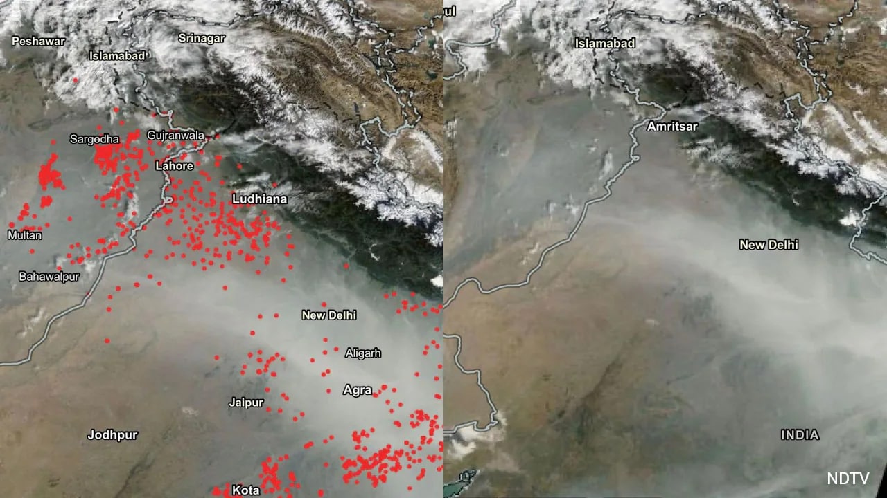
Officially, detected farm fires have fallen dramatically from the peak levels of nearly 80,000 incidents reported in 2021 to roughly 6,000 in 2025. Enforcement measures, penalties, machinery subsidies and awareness campaigns have undoubtedly played an important role. But experts also acknowledge that farmers have become aware of how and when satellites observe their fields.
READ | Farm Fires Are Rising: How Much Do They Add To Delhi's Pollution?
Current operational monitoring relies primarily on four polar-orbiting Earth observation satellites. These include NASA's Moderate Resolution Imaging Spectroradiometer (MODIS) sensors flying aboard the Terra and Aqua satellites, and the Visible Infrared Imaging Radiometer Suite or VIIRS sensors carried on the Suomi NPP and NOAA-20 satellites.
These four systems generate most of the fire alerts used across northern India.
The challenge is that all four observe a given location only during specific times of the day. Their overpasses are clustered around daylight and midday periods.
Recognising this blind spot, iFOREST built Fire Watch to use a larger constellation of satellites rather than rely exclusively on conventional fire counts.
The platform integrates data from MODIS and VIIRS for active fire detection, while adding observations from Meteosat-8 and Meteosat-9 carrying the SEVIRI instrument. Unlike polar-orbiting satellites that make only periodic visits overhead, these geostationary satellites observe the same region repeatedly, generating imagery approximately every fifteen minutes.
This makes it possible to identify not just where fires occur but when burning activity reaches its peak.
The third layer comes from Sentinel-2 imagery. By comparing conditions before and after the burning season, analysts can estimate how much agricultural land has actually burned.
A fire count measures only detected flame events. It does not necessarily reveal the total extent of damage or the actual area affected. Two districts may record similar numbers of fires while very different amounts of farmland are burned.
READ | Stricter Pollution Curbs Under GRAP-III Imposed In Delhi-NCR Ahead Of Diwali
A 2026 Parliamentary Standing Committee recently observed that, despite India's achievements as a leading space power, the country continues to rely heavily on foreign satellite systems for monitoring forest fires and similar environmental events.
The Committee noted significant diurnal observation gaps and urged the Department of Space to prioritise development of a geostationary satellite capable of round-the-clock fire monitoring.